
Last Updated on July 20, 2026 by Cliche
Ever stare at a quiz question about the capital of mexico and think, “Wait, is it Mexico City, Ciudad de México, CDMX, or Distrito Federal?”
You’re not overthinking it. Those labels show up in different eras, on different maps, and in different school materials.
Here’s the simple answer you can trust: Mexico City (also called Ciudad de México or CDMX) is the capital of the United Mexican States.
And yes, it grew from Tenochtitlán, the Mexica (Aztec) city that tradition places on March 13, 1325, in the Valley of Mexico on the old lakebed of Lake Texcoco.
I’ll walk you through the names, the history, and what to look for when you visit places like El Zócalo, UNAM, and Xochimilco.

Overview: Mexico City (Ciudad de México), the Capital of Mexico
Mexico City sits in the Valley of Mexico in North America, built on and around the former Mexica capital of Mexico-Tenochtitlan.
It is Mexico’s political center and a major financial center for Latin America, with a metro area that stretches well beyond city limits into surrounding municipalities.
- Common names you’ll see: Mexico City, Ciudad de México, CDMX (and older materials may say Distrito Federal or DF)
- Big idea for learners: CDMX is the city entity, while “Estado de México” is a different neighboring state
- Travel reality: many famous day trips (like Teotihuacan) sit outside CDMX even though they feel like part of the same urban world
Location and geography
Mexico City sits at about 19.4326° N and 99.1332° W, in a high basin surrounded by mountains and volcanoes.
One fact that explains a lot is elevation: the city sits around 2,240 meters (7,350 feet) above sea level. That can affect your breathing, hydration, and even how tired you feel on day one.
Inside the city, Ajusco reaches about 3,930 meters, and the higher southern areas feel cooler and greener than the dense, flatter center.
- Quick learner tip: if you get a headache on arrival, slow your pace, drink water, and save the big museum marathon for day two
- Why the basin matters: the bowl shape can trap pollution, and the soft former-lake soils connect directly to the city’s sinking problem
The city sits high in the Valley of Mexico, with history underfoot and mountains all around.
Population and size
Mexico City is huge, and the numbers depend on what you mean by “city.”
The city proper (CDMX) and the metro area (often called Greater Mexico City or the Metropolitan Area of the Valley of Mexico) are different, and quizzes love to mix them.
| Summary Point | Data |
|---|---|
| City population (CDMX), 2020 | 9,209,944 residents |
| City land area | 1,495 km² |
| Approx. density (city proper) | ≈ 6,160 people per km² |
| Metro area population, 2020 | 21,436,911 residents |
| Why it matters | Many people live outside CDMX but commute into the capital daily |
Historical Background of Mexico City
Mexico City is one of those places where a single block can hold layers of history: Mexica temples, Spanish colonial churches, and modern government buildings stacked in the same footprint.
A quick way to keep the story straight is to anchor it to a few dates and places you can still see today, like Templo Mayor and El Zócalo.
Watch a short video on Mexico City’s early history
- 1325: tradition places the founding of Tenochtitlán on March 13, 1325
- 1521: Spanish forces capture the city, and colonial New Spain rises on the same ceremonial core
- 1821: independence, with the capital remaining in Mexico City
- 1910s: the Mexican Revolution reshapes politics and public life
Aztec origins: Tenochtitlan
According to sixteenth-century sources, the founding date remembered for Mexico-Tenochtitlan is March 13, 1325, tied to the Mexica migration story and the famous eagle sign.
The Mexica spoke Nahuatl, built causeways across Lake Texcoco, and turned wetland farming into a system that fed a growing city.
If you want a concrete “this really happened here” moment, visit the Templo Mayor complex. The on-site museum opened on October 12, 1987, and it was created because excavations in the late 1970s uncovered major remains right in the historic center.
- Study trick: connect the flag symbol (eagle and cactus) back to this origin story, it helps you remember the capital’s roots fast
- Place-name clue: you’ll still see Nahuatl in place names across the city, including Xochimilco
Spanish conquest and colonial era
In 1521, Spanish forces led by Hernán Cortés captured Tenochtitlán after a long siege, and the new colonial capital took shape around the main plaza we now call El Zócalo.
“The city rose on the footprint of an empire, and its heart still beats where the old temples stood.”
One landmark that makes this “built-on-top-of” story easy to visualize is the Metropolitan Cathedral. Work began in 1573 and finished in 1813, on the same core area near the former ceremonial precinct.
When you stand between the Cathedral and Templo Mayor, you are looking at a lesson in how Mesoamerica and colonial New Spain collided, merged, and left traces you can still read.
- On-foot route: Zócalo, Cathedral exterior, Templo Mayor museum, then a loop through the surrounding streets for plaques and ruins
- Art link: later muralists like Diego Rivera and David Alfaro Siqueiros turned these history themes into public art you can spot around the city
Independence and modern development
Mexico City stayed the seat of power after independence in 1821, and it remained the stage for major historical events across the nineteenth and twentieth centuries.
The city saw fighting during the 1847 U.S. invasion, and it faced political violence again during February 1913 in the Decena Trágica, which ended with the assassination of President Francisco I. Madero.
In recent years, the city has also lived through dramatic natural disasters that reshaped public policy, including the September 19, 1985 earthquake and the September 19, 2017 quake.
- Why learners remember this city: history is not just in textbooks here, it is in street layouts, plazas, and memorials
- Modern leadership note: Claudia Sheinbaum, once a CDMX head of government, became Mexico’s president in 2024, while the city now has its own head of government
Political Significance of Mexico City
Mexico City is the national political hub. It hosts the National Palace, federal ministries, and top courts, all within a few minutes of El Zócalo.
It also has its own local government, congress, and 16 borough governments, so you get two layers of civic life in one place.
Watch a short video on Mexico City’s role in national government
Role as the Federal District
For decades, people called the capital the Distrito Federal (DF). That name still shows up in older textbooks and older address formats.
The key modern shift is this: on January 29, 2016, the city stopped being officially labeled Distrito Federal and became Ciudad de México (CDMX).
Then the city gained a clearer local constitutional framework. In the official decree for the city’s constitution, it is listed as entering into force on September 17, 2018 (with separate timing for electoral rules).
- Form-filling tip: if a form asks for your state or entity and you are in the capital, choose Ciudad de México (CDMX), not Estado de México
- Quiz tip: DF is a historic label, CDMX is the modern official shorthand
Government institutions and headquarters
Government work clusters around the historic center, with many major buildings within walking distance of the Zócalo.
- Head of government: Mexico City has a head of government, and Clara Brugada took office on October 5, 2024.
- Local legislature: the Congress of Mexico City passes city laws that affect housing, transport, and public services.
- Federal seats nearby: the federal executive offices and national ceremonies often center on the Zócalo area.
- Local borough layer: the 16 alcaldías handle many everyday services in their territories, from public spaces to neighborhood permits.
- Why it matters for learners: “capital city” here means both national power and local city government at the same time.
Economic Importance of Mexico City
Mexico City is a national economic engine, and it has long been Mexico’s main financial center.
You’ll see that in the concentration of headquarters, banks, public institutions, universities, and tourism infrastructure across the city.
Watch a short video on Mexico City’s economy
Major industries and sectors
The city’s economy leans heavily toward services, with finance, government, media, education, and hospitality playing outsized roles.
| Sector | What it looks like on the ground | A “so what” for learners |
|---|---|---|
| Services, finance, and government | Corporate corridors, legal and accounting firms, federal offices, and local government services | If you are studying civics or economics, this is the clearest place in Mexico to connect policy decisions to daily markets |
| Tourism and hospitality | Museums, walking tours, restaurants, hotels, and festival crowds in the historic center, Reforma, and Chapultepec | History is not an abstract topic here, it drives jobs and city planning |
| Education and research | Major universities like UNAM and IPN plus public research institutes | Great for learners who want museum-level learning and campus-level learning in the same week |
| Creative industries and media | Film, publishing, design, music, and public art | Muralism and modern media help explain why Mexico City shapes culture well beyond Mexico |
| Informal economy | Street vendors, neighborhood markets, and small family-run businesses | If you study urban life, this is where you see how a megacity feeds itself every day |
Contributions to Mexico’s GDP
Mexico City contributes an outsized share of national output, mainly because so many service and government functions cluster in one place.
In its latest published results for the city entity, Mexico’s national statistics institute reported that Ciudad de México’s nominal GDP for 2023 was 4,717,467 million pesos, with a strong tilt toward services.
| Metric | Value | How to read it |
|---|---|---|
| Nominal GDP (Ciudad de México), 2023 | 4,717,467 million MXN | Use this as the clean “city entity” GDP figure when you see conflicting numbers online |
| Real growth (year over year), 2023 | +4.3% | Helps you separate inflation effects from actual growth |
| Sector mix (share of entity GDP), 2023 | Primary: 0.0% Secondary: 9.9% Tertiary: 83.5% Net product taxes and subsidies: 6.6% |
If you are learning economic geography, this table is a quick argument for “service-heavy capital city” |
Cultural Significance of Mexico City
Mexico City is a culture-heavy capital. You can move from Aztec ruins to colonial cathedrals to modern murals in a single walk.
If you are learning history, art, architecture, or even food culture, this city gives you real-world examples with labels, museums, and guided routes.
Architecture and landmarks
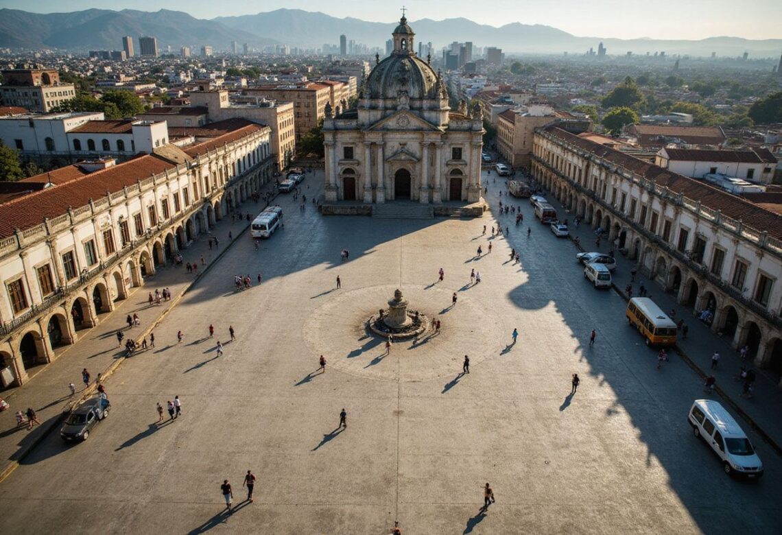
The city’s most famous core is the historic center around El Zócalo, where civic life has played out for centuries.
UNESCO inscribed the Historic Centre of Mexico City and Xochimilco in 1987, which is a helpful date to remember because it often shows up in study materials.
UNESCO also inscribed the Central University City Campus of UNAM in 2007, a big clue that the campus is not just a school, it is a cultural site.
For green space, Chapultepec Park is massive. The city’s environmental authority lists it at about 686.01 hectares, spread across three sections.
- Easy learning walk: Chapultepec Park, National Museum of Anthropology, then Reforma monuments
- Photo anchor: Zócalo and the Cathedral give you the clearest “capital city” skyline in one frame
Museums and historical sites
Museums in Mexico City work well for learners because many exhibits are carefully labeled, bilingual in key spaces, and built around real artifacts, not replicas.
- National Museum of Anthropology: inaugurated on September 17, 1964, it is a top place to connect names like Aztecs, Maya, and Olmec to real objects.
- Templo Mayor Museum: opened on October 12, 1987, right where the Mexica ceremonial precinct stood, it helps you picture Tenochtitlán under the modern city.
- Ciudad Universitaria (UNAM): go for murals, architecture, and the feeling of post-revolution Mexico building a modern identity.
- Alameda Central: established in 1592, it is often described as the oldest public park in the Americas, and it sits near major cultural venues.
- Xochimilco: ride a trajinera to see surviving canal life tied to the old lake system and chinampa farming traditions.
Cuisine and traditions
Food is one of the fastest ways to learn a city, because it connects migration, class, family life, and local slang in a single meal.
Start with street-friendly classics like tacos al pastor, tamales, and mole, then compare what you taste in different neighborhoods like Centro Histórico, Condesa, Roma, and Coyoacan.
- Market rule for travelers: pick busy stands with high turnover, hot food, and clean prep surfaces
- Culture word to know: many locals use chilango for Mexico City identity, often with pride
Environmental Challenges in Mexico City
Mexico City deals with a tough mix: air pollution, water stress, ground sinking, and earthquake risk.
The good news for learners is that the city is also a real-world lab for solutions, from transit policy to emergency drills to water infrastructure projects.
Air pollution issues
The valley basin can trap pollution, and ozone spikes still happen in the warm season.
For a concrete recent example, the city government announced an ozone-related environmental contingency on March 10, 2026, which shows that air alerts are not just a “1990s problem.”
- Action step for travelers: plan your longest outdoor day (parks, canals, pyramids) for a day with good air readings
- Driving reality: the city uses the Hoy No Circula program to limit vehicle circulation on certain days and during contingencies
Water scarcity and management
Mexico City sits on the former lakebed of Lake Texcoco, and that history still shapes its water system and its sinking ground.
Part of the city’s supply comes from the Cutzamala System, which transfers water into the metro area and lifts it more than 1,000 meters. A widely cited estimate for the transfer share is about 19% of total supply.
Leaks are a big part of the problem too. Research on the metro area’s water system often cites losses around 40% in the network due to leaks and other losses, which means saving water is not only a personal habit, it is a system challenge.
- Practical habit: take shorter showers, and reuse towels in hotels, small choices add up in a water-stressed city
- Neighborhood clue: if you hear about “tandeo” (scheduled water delivery), you are hearing the city adapt to uneven supply
Urban sprawl and sustainability efforts
Greater Mexico City spread far beyond the original core, turning the basin into a continuous urban zone.
That makes good transit and protected green areas more than “nice to have,” they are tools for public health and daily mobility.
- Transit emissions angle: systems like Metro and Metrobús help reduce car dependence in a mega-commute region
- Green space angle: southern areas such as Milpa Alta, Tlalpan, and Xochimilco remain important for ecological balance and recharge zones
Transportation in Mexico City
Mexico City has one of the biggest transit networks in the Americas, and for learners and travelers it can be part of the lesson, not just a way to get around.
The easiest win is to use one payment tool across multiple systems: the Tarjeta de Movilidad Integrada (Integrated Mobility card).
Public transit systems
The backbone systems are the Metro and Metrobús, supported by trolleybuses, RTP buses, and other lines.
- Metro fare: the Metro lists a $5.00 MXN cost per trip in published mobility documents.
- Metrobús fare: Metrobús lists a $6.00 MXN fare for a trip.
- Integrated Mobility card: the plastic card is commonly listed at $15.00 MXN (then you add balance for rides).
- Hours to remember: many lines run late, and common posted schedules include Metro service from early morning until midnight, with later starts on weekends.
- Modern payment shift: Mexico City’s own travel guidance says the old magnetic paper ticket was phased out on March 1, 2024, which is why the integrated card matters now.
Cycling and pedestrian infrastructure
Ecobici is the city bike-share program, and it is a great learning tool because it makes neighborhoods feel close.
For visitors, Ecobici lists foreign-user passes such as a 1-day pass at $278 MXN and a weekly pass at $1,110 MXN, both built around unlimited rides up to a time limit per trip.
In a 2026 update, Mexico City’s mobility department said Ecobici had more than 185,000 active members during 2026, a useful clue that bike-share is not just for tourists.
- Street-smart tip: ride Reforma on Sunday mornings when roads often feel calmer and more bike-friendly
- Walking upgrade: pair short Metro rides with walks in Roma, Condesa, and Centro Histórico to learn the city block by block
Major roads and highways
Road travel is real in a metro this large, yet traffic and vehicle restrictions can turn a short drive into a long one.
- Paseo de la Reforma: key for monuments, museums, and big city marches, it is a fast way to connect major sights.
- Anillo Periférico: the big ring road that links many suburban zones to the core, expect heavy rush-hour pressure.
- Circuito Interior: an inner loop that can save time if downtown streets slow.
- Avenida Insurgentes: a long north-south spine with major bus corridors and dense commercial stretches.
- Driving rule to check: the Hoy No Circula program can restrict vehicles by day and conditions, including some non-local plates.
Unique Features of Mexico City
Mexico City’s geography creates two famous “science class” topics you can see in real life: the city sinks in places, and earthquakes can shake it hard because of the soft lakebed soils.
If you remember only one cause, remember this: the old lakebed of Lake Texcoco left soft clay under many neighborhoods.
Why is Mexico City sinking?
Groundwater pumping compresses the clay soils, and the ground settles unevenly across the city.
In a 2026 update about satellite mapping, NASA described parts of the metro area sinking at around 14 inches (35 centimeters) per year in the 1990s and 2000s, which helps explain why roads, pipes, and buildings need constant engineering attention.
- What this means for daily life: cracked sidewalks, tilted buildings, and stressed water pipes are not random, they track where the ground shifts
- Traveler choice: when picking lodging, prioritize well-maintained buildings and follow staff guidance after heavy rain
Earthquake vulnerability and preparedness
The same soft basin soils that come from the old lake system can amplify shaking during quakes.
Mexico City learned this painfully on September 19, 1985, and building codes changed after that tragedy.
Mexico also built the SASMEX early warning system. Mexico’s disaster prevention agency has noted that, historically in Mexico City, alerts for quakes off the Guerrero coast can offer roughly 100 seconds of warning time, while closer quakes may offer only seconds.
- Hotel habit: find the stairs on arrival, then you do not waste time searching later
- Drill habit: practice “drop, cover, hold on” once, it feels silly until it matters
- Street habit: after shaking, move away from glass and older facades, and follow official instructions on-site
Boroughs and Neighborhoods of Mexico City
Mexico City is divided into 16 alcaldías (boroughs). Each can feel like its own small city, with distinct parks, markets, and local routines.
If you are learning geography or social studies, this division is also a great way to organize your notes.
Overview of administrative divisions
Think of alcaldías as a city-level layer below the main CDMX government, each with its own local leadership and services.
| How CDMX is organized | What it means for you |
|---|---|
| 16 alcaldías (boroughs) | Good for planning: museums and parks cluster by borough |
| Colonias (neighborhood units) inside each borough | Addresses and local identity usually follow colonia names |
| Big area with very different terrain | South and west are higher and greener, the center is denser and flatter |
- Memory trick: “alcaldía” is the borough, “colonia” is the neighborhood inside it
- Study shortcut: group your notes by Centro, Reforma, Chapultepec, Coyoacán, Xochimilco
Popular neighborhoods to explore
Here are a few places that make learning feel easy because the city gives you lots of cues: plaques, museums, murals, and public space that invites slow walking.
- Condesa: tree-lined streets near Parque México and Parque España, good for walking breaks between study stops.
- Roma: cafés, galleries, and street architecture that helps you see how neighborhoods change over time.
- Coyoacán: colonial plazas and Frida Kahlo connections, great for art and history learners.
- Centro Histórico: Zócalo, Cathedral, and Templo Mayor are packed into a tight area for a high-impact history day.
- Xochimilco: canals and chinampa culture, a living clue to the old lake system.
- Polanco (Miguel Hidalgo): close to Chapultepec museums, good for a museum-focused itinerary.
Tourism in Mexico City
Mexico City is an ideal learning trip because many top attractions sit close together, and transit can link them cheaply.
A simple plan is to anchor each day to one big theme: ancient Mexico, colonial Mexico, modern Mexico, and nature.
Top attractions and destinations
These spots teach fast because they connect stories to physical places you can see.
- El Zócalo and the Historic Center: the heart of public life, where you can compare Mexica ruins, colonial buildings, and modern politics in one walk.
- Templo Mayor: your clearest window into Tenochtitlán inside the modern city grid.
- Chapultepec Park: a huge urban park (about 686 hectares) that holds multiple major museums and long walking routes.
- National Museum of Anthropology: a top-stop museum inaugurated in 1964, built for deep artifact-based learning.
- Xochimilco: trajineras, canals, and a direct connection to the old lake landscape.
- Teotihuacan day trip: the ancient city sits about 40 km northeast of Mexico City, and many guides describe the trip as roughly a 50 km distance depending on how you measure it.
Festivals and cultural events
Mexico City runs on public celebrations, and the biggest ones often center on Reforma and the Zócalo.
- Day of the Dead: Mexico City held its first major modern Day of the Dead parade on October 29, 2016, and it has become a major seasonal draw.
- Independence Day: September 16 brings speeches, crowds, and fireworks energy around the Zócalo.
- Neighborhood fairs: local celebrations in places like Coyoacán and Xochimilco can be smaller and more personal, with crafts, food, and music.
Tips for travelers
Most U.S. travelers find Mexico City easy to move around, as long as they plan for altitude, transit crowds, and the city’s environmental realities.
Mexico City is on Central Time. In 2026 it does not observe daylight saving time, and it last observed it in 2022.
- Altitude tip: at about 2,240 meters, take it easy on day one and drink water often.
- Transit tip: pick up a Tarjeta de Movilidad Integrada, then keep small balance topped up to avoid lines.
- Safety tip: keep your phone secure in crowded stations, and keep your bag closed in busy tourist zones.
- Air tip: on poor air days, swap long outdoor hikes for indoor museums.
- Water tip: treat drinking water carefully, follow your hotel guidance, and favor sealed or filtered options.
- Earthquake tip: learn what the alert sounds like where you stay, and keep shoes near your bed.
International Relations and Connections
As the capital, Mexico City hosts embassies, consulates, and constant international travel, and that shapes everything from food to business to festivals.
It also keeps many city-to-city partnerships that support cultural exchange and education.
Sister cities and global partnerships
Sister-city links often show up in student exchanges, cultural weeks, and city planning partnerships.
Two well-known U.S. connections are sister-city ties with Los Angeles and Chicago, which reflects the deep people-to-people connections between these cities.
- Why this matters for learners: global ties are not abstract, they create real programs, events, and shared projects
- Easy example: you can often spot international exhibits and visiting shows in major museums and cultural centers
Mexico City’s global influence
Mexico City is a regional hub for finance, media, education, and politics, and its metro size gives it a massive labor pool.
In the 2024 update from the Globalization and World Cities Research Network (GaWC), Mexico City is listed as an Alpha++ world city, placing it in a top connectivity category.
- Learning lens: a city can be global because of service networks, not only because it is a capital
- Practical sign: international conferences and nonstop flight networks tend to cluster where these service links are strongest
Education in Mexico City
Mexico City is one of the best places in the Americas to study in real life, because universities, libraries, museums, and public culture sit close together.
It is also a place where architecture and education connect, especially at UNAM.
Major universities and research centers
These institutions show up again and again in Mexico’s public life, science, and culture.
- Universidad Nacional Autónoma de México (UNAM): its Central University City Campus is a UNESCO World Heritage site, inscribed in 2007, known for the integration of art and architecture.
- Instituto Politécnico Nacional (IPN): a major engineering and technology training hub with strong applied programs.
- CINVESTAV: a high-level research center known for advanced science and engineering work.
- El Colegio de México (COLMEX): a major graduate and research center for social sciences and humanities.
- Instituto Nacional de Medicina Genómica: a key research institution tied to public health and genomics.
Educational opportunities for residents
For residents and long-stay learners, Mexico City offers a dense mix of public universities, private programs, and research spaces.
If you want a simple plan, build a study week around three anchors: one major museum day (Anthropology), one ruins day (Templo Mayor), and one campus day (UNAM). That mix gives you artifacts, architecture, and living city life in a balanced way.
- Low-cost learning: many museums offer discounts for students, and public spaces like Chapultepec make breaks easy
- Skill-building angle: the city is a strong place to practice Spanish in real settings, from markets to transit to guided tours
Conclusion
Mexico City is the capital of mexico, and it is much more than a dot on a map.
It is the political center of the United Mexican States, a cultural heavyweight, and a financial center that shapes the country’s daily life.
If you came here just to clear up CDMX vs DF, here’s the memory hook: DF is the older label, CDMX is the modern official shorthand, and Mexico City is the capital either way.
Now, meet Dr. Ana Morales.
She holds a PhD in urban geography from UNAM, and she brings decades of field work into how she explains this city.
She has taught, advised public agencies, and worked with global organizations on urban planning questions that matter in the Valley of Mexico.
Her research focuses on the pieces you can feel in daily life: sinking ground, water stress, and the way air and traffic move inside a high basin.
Dr. Morales also stresses a simple truth that helps learners: Mexico City’s strengths and limits come from the same roots.
The old lakebed soils that supported Tenochtitlán help explain why the modern city can sink, and why infrastructure needs constant care.
The basin setting that makes the skyline beautiful can also trap pollution, so public policy and personal habits both matter.
She points out that the city’s big institutions, its universities, and its museum network create real opportunity.
You can study Aztec empire history at Templo Mayor, walk colonial New Spain streets around El Zócalo, and then take the Metro to a modern campus where murals tell post-revolution stories.
That is rare, even among world capitals.
Dr. Morales keeps the advice practical.
Save water when you can, plan outdoor days around air conditions, and learn the basics of earthquake drills before you need them.
If you live here or stay for a while, she recommends choosing transit often, because it saves time in traffic and reduces emissions.
She also encourages respect for UNESCO sites and for communities that carry the city’s living traditions, from Xochimilco to neighborhood markets.
In her view, good governance depends on transparency, honest reporting on water and pollution, and building safety that people can trust.
Her verdict is clear: Mexico City rewards curiosity.
For learners, it offers hands-on lessons in history, politics, culture, and urban life that stick long after the quiz is over.
For planners and decision-makers, it remains a city that demands bold, realistic action on water, soil, and mobility, because the stakes are visible on every street.
FAQs
1. What is the capital of Mexico?
Mexico City is the capital of Mexico, it is the seat of government and a busy cultural center.
2. Why is Mexico City the capital?
It grew from an Aztec center into the colonial seat, and then into the modern government hub. Think of it as the nation’s heart, where politics, art, and daily life meet.
3. Is the capital of Mexico also the largest city?
Yes, the capital city is the biggest, in people and in size, so it wears many hats.
4. How can I visit the capital of Mexico?
Fly into the main international airport that serves the capital city. Use the subway and buses to get around, traffic can be heavy so leave extra time. Try the local food, it tells the city’s story.
Read more lifestyle and travel articles at ClichéMag.com
Images provided by Deposit Photos, BingAI, Adobe Stock, Unsplash, Pexels, Pixabay Freepik, & Creative Commons. Other images might be provided with permission by their respective copyright holders including AI generators.